[in formZ, the cylinder changes from green to yellow-green. the country is india. there appears to be a shadow of the animation that appears to the left. this doesn't show up in formZ. open to suggestions]
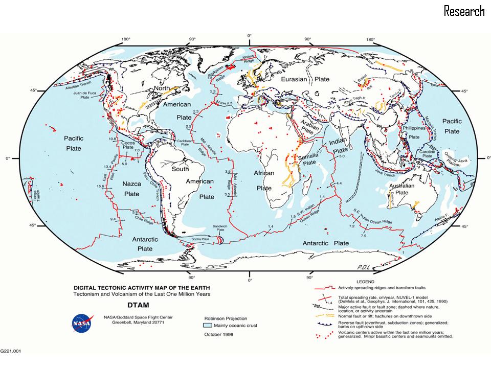
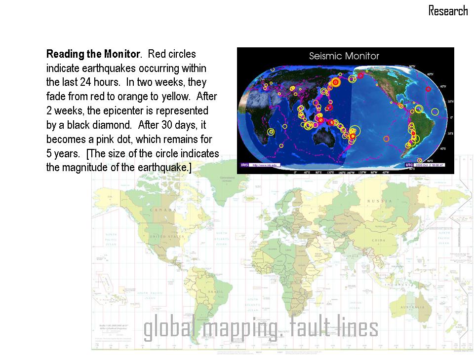
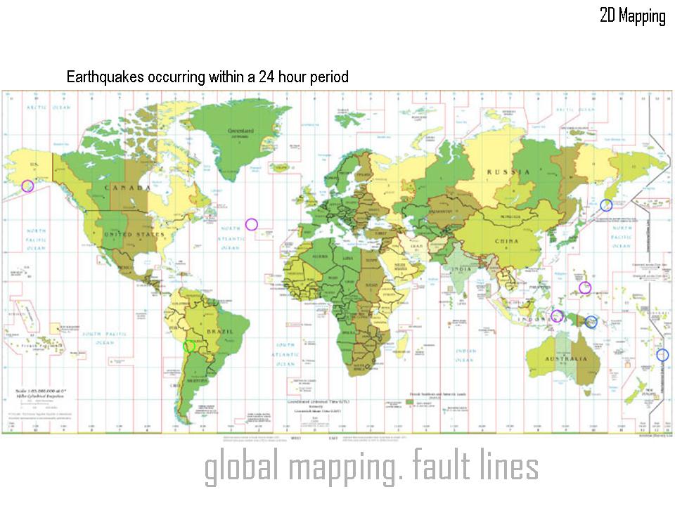
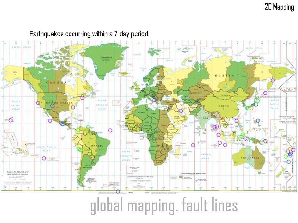
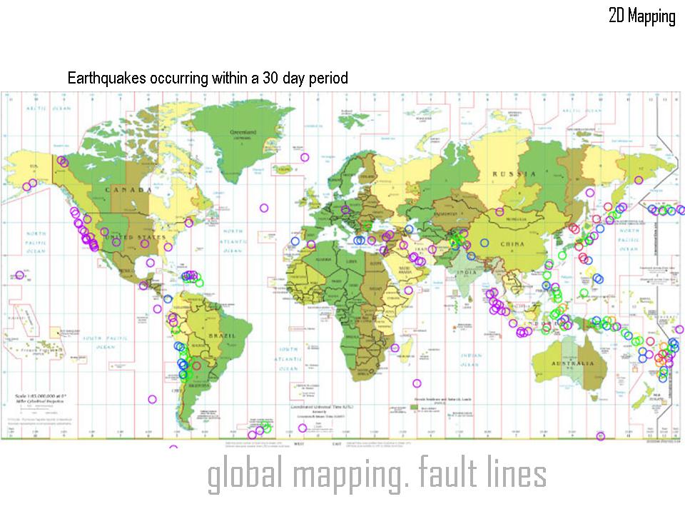
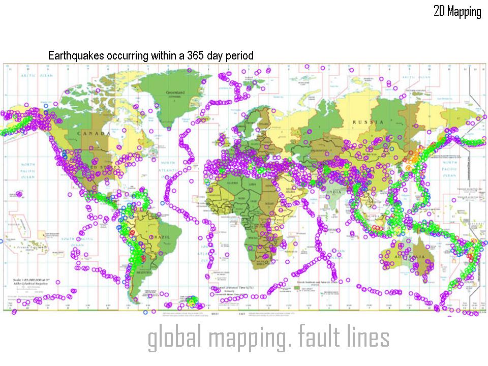
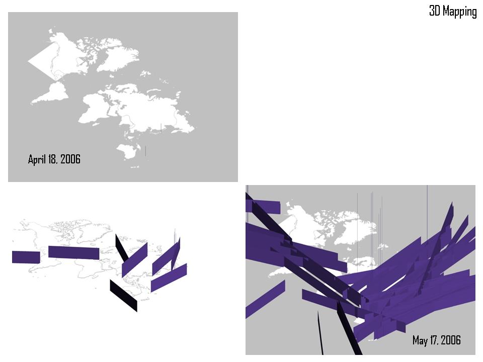
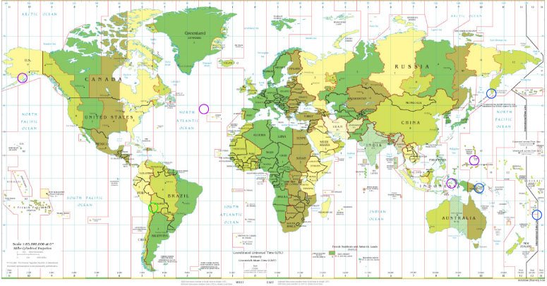
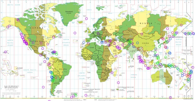
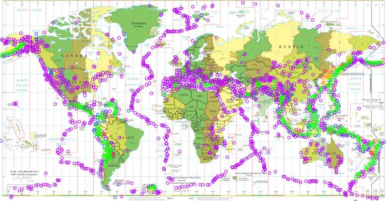
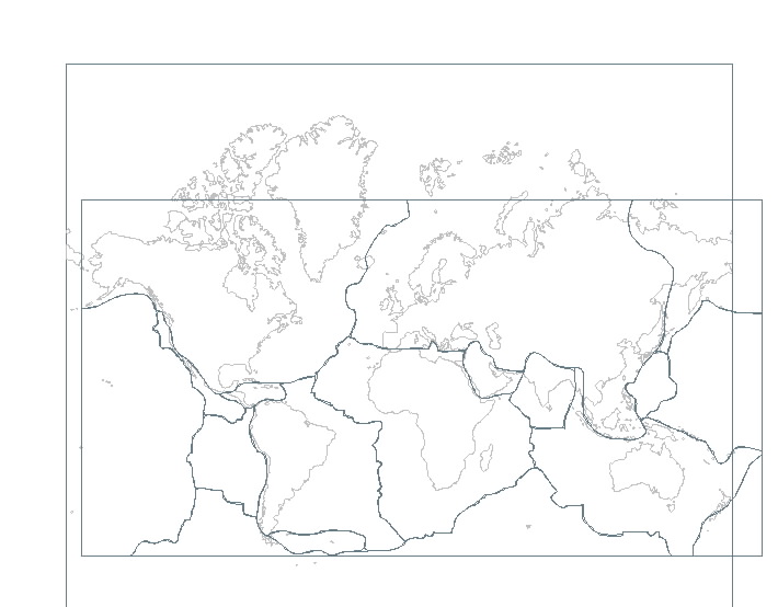
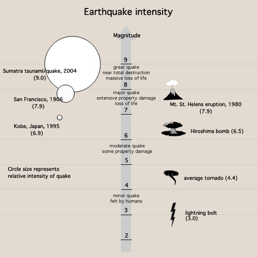
My maps show progression over time of earthquakes that measure on the Richter Scale. The outline of the tectonic plates becomes very easily visible after one year of recordings. I am mapping the fault lines and the movement of the plates and how this is visible and seismically recorded by earthquakes in particular [other natural disasters also occur along the edges of the fault lines, mapping out the tectonic plates as well].
Friday, October 13, 2006
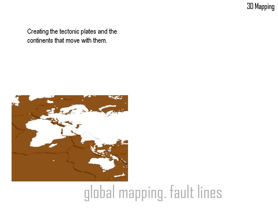
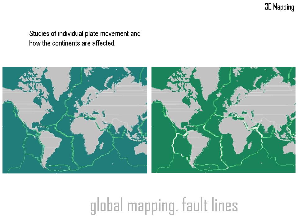
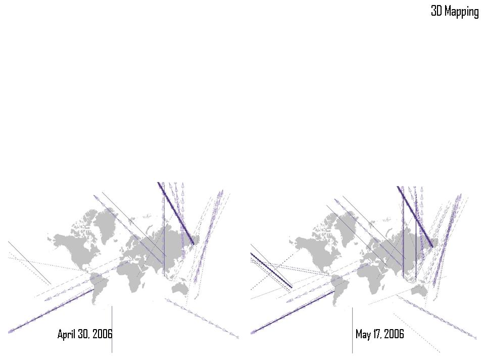
I have all of the tectonic plates drawn and extruded on a base map in formZ. I am moving the plates with animation. The problem arises when the plates interact with one another. I am struggling with forming the edges of the two objects into one form. Maybe my problem would be solved by simply creating new objects which form into pulsing mountain shapes at the location of potential earthquakes instead of trying to mesh two plates together. Another problem is what occurs in the rifts or the trenches as a result of the moving plates. I am not sure what could represent those areas.